Detroit printable and editable street maps

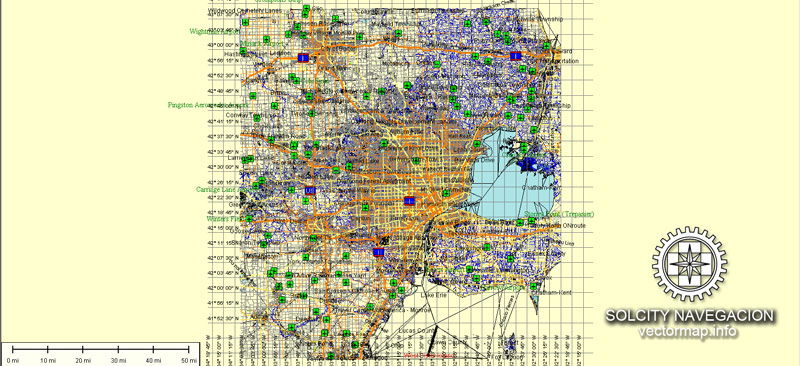
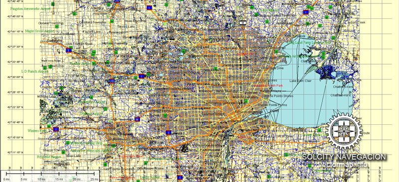
The Detroit, MI City Map offers an affordable medium-detail vector map of the greater metropolitan area in editable Illustrator or PDF format. Each individual layer can be individually edited or easily turned off, allowing the designer a great deal of flexibility to show or hide as much detail as is required by the project. See the sidebar for a complete list of features / layers available on this digital map.
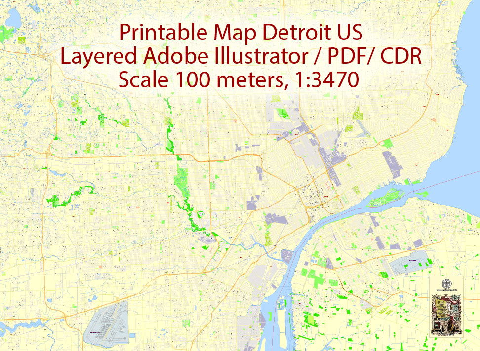
This printable map of Detroit is fully editable and ready for high resolution printing.
 Features / Layers on This Map
Border & Scale
Text
Railroad / Rail Lines
Highways (not labeled)
Roads (road names are *not* labeled)
Hydro / Water Casings
Water Features
Landmark Fill
City Borders
National Park Borders
County Borders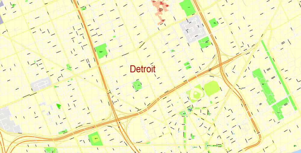 Product Description
This Detroit, MI City Map also contains border outlines for the following neighboring cities: Eastpointe, Warren, Ferndale, Southfield, Dearborn, Detroit, Ecorse, Hamtramck, Inkster, Livonia, Romulus, Southgate, Taylor, Westland, Wyandotte, Dearborn Heights, Farmington Hills, Allen Park, Lincoln Park, River Rouge, Hazel Park, Oak Park, Highland Park, St. Clair Shores, Harper Woods, Grosse Point Woods, Grosse Pointe Farms, Grosse Point, Gross Point Park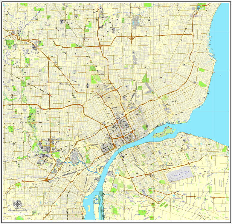
A highly detailed map of Detroit is used for designs, architect planning, presentations, large size printing and other purposes.
Additional Info
These blank city maps are made from government data sources. Data quality varies throughout the country due to different data sources. Some maps may have missing street lines, ownership borders, annexes, and label errors which we have no control over. Maps should be used for general overviews of cities, road networks, borders, and regions and not as a close-up representation of city streets. These maps have a resolution of 300 dpi so it is suggested that no more than a 200-300% zoom be used, since major distortion will show at greater zoom levels.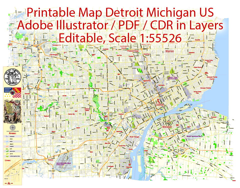 This map is also delivered as a fully-editable Adobe PDF map file. This raw PDF file can be opened using the free Adobe Reader software, which allows you to zoom into any portion of the map while maintaining crisp lines and text at any level of magnification. All of our Adobe PDF map files can be easily incorporated into a wide range of other software products, such as Microsoft Word and PowerPoint, as well as Adobe Photoshop and Illustrator. Our PDF maps are also 100% editable in Illustrator 10 and higher, allowing you to select and edit any object on the map (such as state/county/country boundaries, road lines, map symbols, text, etc.). All major map objects reside on their own intuitively labeled layers, allowing you to easily show/hide, edit and delete each main map object. For a complete list of features/layers, refer to the list in the sidebar.
Easily editable map of Detroit, all objects are on a separated layers.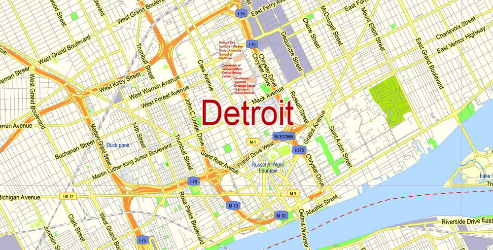 Detroit is known as America's traditional automotive center, the city's name is sometimes used as a synonym for the American automobile industry. The annual North American International Auto Show (NAIAS) is held in Detroit.
Detroit's Motown Sound and world famous artists such as John Lee Hooker, Stevie Wonder, The Temptations, Diana Ross & The Supremes, The Jackson 5, Aretha Franklin and many other musicians shaped the reputation of Detroit as a music city.
You can change the color scheme of Detroit printable map anytime. Find more printable and editable maps in vector.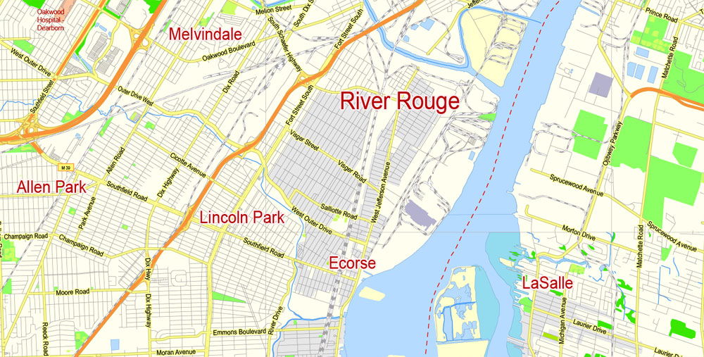 All of our editable Detroit vector maps are instantly downloadable digital files in either editable PDF or Adobe Illustrator format. Because each of our Detroit digital maps is available in the Adobe Illustrator or editable PDF format, both of which use a vector based approach to displaying images, you can easily zoom into any portion of our maps without any degradation in the quality of the text, lines and symbols of the map --- regardless of the magnification factor. Using a vector graphics editor such as CorelDraw, Freehand or Illustrator, you can then easily crop portions of your map, add custom symbols, and change colors and font attributes as you need. We have a wide-variety Detroit vector maps with varying levels of detail from simple blank outlines to highly-detailed maps with roads and terrain layers.
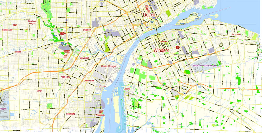
This printable map of Detroit is a perfect solution for your brochure or a company presentation.