Los Angeles printable maps, USA
The Los Angeles, CA City Map with Roads & Highways is an 30" x 30" map which can be easily zoomed in on and magnified to virtually any size. This map was created at 600 DPI for better road shape when zoomed in. Please note that this city map is sold with unedited placed text, which may require editing and final placement.
This printable map of Los Angeles is a perfect solution for your brochure or a company presentation. 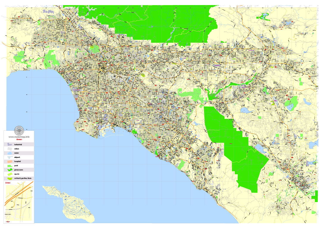 Hollywood, a district in the central LA, is known as the original movie mecca, the majority of US movie studios are headquartered in Los Angeles.
The city is home to the Kodak Theatre, today known as Dolby Theatre, located close to Hollywood Boulevard in the Hollywood district of Los Angeles. The theater is home of the annual Academy Awards Ceremonies (The Oscars), which were first held there in March 2002, it is the first permanent home for the awards.
Please check this link if you need more street maps in vector.
More points of interest in LA:
You can change the color scheme of Los Angeles printable map anytime.
The Walk of Fame at the Hollywood Boulevard, Los Angeles, California, USAThe Walk of Fame at the Hollywood Boulevard.
Image: Diliff
Hollywood Boulevard, with the famous Hollywood Walk of Fame, more than 2,500 stars bearing the biggest names in the entertainment industry on its sidewalks. Disneyland, the "original", now named Disneyland Park, a must for Disney aficionados. La Brea Tar Pits and Hancock Park, titans of the ice age, fossil excavation site with an adjacent museum and a recreated prehistoric garden. Natural History Museum of Los Angeles County (4.5 billion years of history); Hollywood Bowl (live music); Universal Studios Hollywood (film studio and movie-themed amusement park); Getty Center and J. Paul Getty Museum (fine arts); Museum of Contemporary Art (fine contemporary art); Griffith Park (urban park) with the Griffith Observatory (observatory, exhibit hall, and planetarium); Muscle Beach, Santa Monica (birthplace of the physical fitness boom in the US).
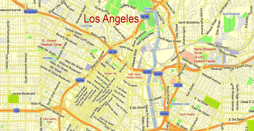
The main goal of printable map of Los Angeles is that your client almost never throw it away. Just zoom in (+) to see LA City Hall, the center of the government of the city of Los Angeles and until 1964 the tallest building in Los Angeles.
The page shows a city map of Los Angeles with expressways, main roads and streets, zoom out to find Los Angeles International Airport (IATA code: LAX), located in southwestern Los Angeles near Inglewood, distance from downtown: 18 mi (29 km), and the location of LA/Ontario International Airport, 40 mi (64 km) by road in Ontario, San Bernardino County.
To find a location use the form below. To view just the map, click on the "Map" button.
Easily editable map of Los Angeles, all objects are on a separated layers. To find a location type: street or place, city, optional: state, country.
Additional Information:
IMPORTANT NOTE:
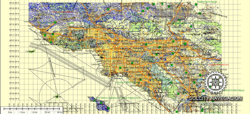
This map comes with a very large text layer with thousands of pieces of text. A workstation with a minimum of 2GB RAM is required to open and make edits to this map. To avoid slow redraws, stalls, and crashes, it is also recommended that you delete the text you don't need for your project before editing your text. Make a copy of the master file before deleting anything.
A highly detailed map of Los Angeles is used for designs, architect planning, presentations, large size printing and other purposes.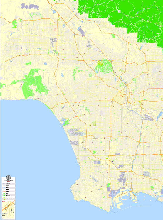 This Los Angeles, CA City Map with Roads & Highways is a fully editable, layered Adobe Illustrator file. Adobe Illustrator files are vector format files, allowing for crisp, high-quality artwork at any magnification. All major map objects / features reside on their own layer. For a complete listing of objects/layers, refer to the list in the sidebar.
This map is also delivered as a fully-editable Adobe PDF map file. This raw PDF file can be opened using the free Adobe Reader software, which allows you to zoom into any portion of the map while maintaining crisp lines and text at any level of magnification. All of our Adobe PDF map files can be easily incorporated into a wide range of other software products, such as Microsoft Word and PowerPoint, as well as Adobe Photoshop and Illustrator. Our PDF maps are also 100% editable in Illustrator 10 and higher, allowing you to select and edit any object on the map (such as state/county/country boundaries, road lines, map symbols, text, etc.). All major map objects reside on their own intuitively labeled layers, allowing you to easily show/hide, edit and delete each main map object. For a complete list of features/layers, refer to the list in the sidebar.
This printable map of Los Angeles is fully editable and ready for high resolution printing.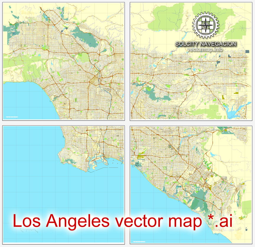 Features / Layers on This Map
Arrow & Scale
Latitude & Longitude Lines
Border
Rails (railroad lines)
Freeways & Toll Roads
Major Roads
Minor Roads
Dirt / Gravel Roads
Private Roads
Trails
Alley (alleys)
Water Features
Rivers & Streams
Indian Reservations
Prisons
Cemetery
Airport
Golf Course
Hospitals
Univerities & Schools
Shopping Districts
State Parks
Military
Parks
Industry & Industrial Areas
Cities
Zip Codes
County / Counties
Docks & Piers